
HUMMINBIRD
COASTMASTER®
MARINE CHARTS
JUMP TO INFORMATION ABOUT: COASTMASTER | COASTMASTER PREMIUM | COASTMASTER VIDEOS

PLAN YOUR ATTACK
WITH INDUSTRY-LEADING MARINE CHARTS
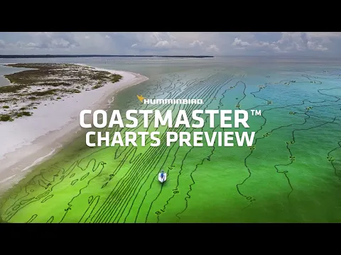
Find the path to your next big catch with the incredible accuracy and detail of Humminbird® CoastMaster® and CoastMaster® Premium Charts. With easy-to-read contours and chart customization, you'll have the tools you need to identify the spots you know will hold fish and navigate there safely. Building on the latest data available, CoastMaster charts deliver unrivaled nearshore and offshore fishing performance.
COMPLETE COASTAL COVERAGE
We’ve got you covered from sea to shining sea. Always know where you are and what’s ahead with full chart detail for the East Coast, West Coast, and the Gulf of Mexico, complete with 3, 9, 12, 24, and 200-mile markers. (CoastMaster, US Coastal Only)

VX TECHNOLOGY
Don’t delay. VX technology provides five customizable color palettes and fast map load times, so you can seize every moment on the water.

CHART VIEWS
See the world your way with three chart view presets. Individually customize Fishing, Navigation and User presets to quickly cycle between your favorite settings for specific fishing scenarios. Spend less time with settings, and more time setting the hook.

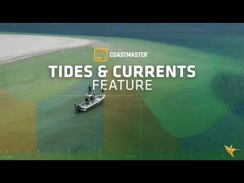
TIDES AND CURRENTS
Whichever way the tide rolls, make sure it’s in your favor. CoastMaster’s predictive software allows you to plan your fishing day with tidal direction and height, as well as the speed and direction of currents and more, so you’ll never be caught guessing.


Create up to four user-defined depth highlight ranges, so you can easily target productive water and stay in the bite zone.

Navigate safely and quickly identify spots where fish are hiding with red shading highlights for shallow water areas on an adjustable range from zero to 30 feet.

Synchronize the depth contours and shorelines of your CoastMaster charts with the actual water levels, so that your chart will reflect the current water level of your fishing spots.

Quickly find areas that will dry out during low tide, highlighted in green, allowing you to better understand fish movement and identify your navigation route.
NAVIGATE WITH CONFIDENCE
In addition to exclusive features designed for saltwater fishing, CoastMaster gives you access to a wealth of marine maps and data to make your next trip safe and successful. View navigation aids, artificial reefs, points of interest, and premium marina information from Waterway Guide.

BETTER TOGETHER
CONNECT YOUR MARINE CHARTS TO YOUR TROLLING MOTOR
Unlock more from your CoastMaster chart with the power of One-Boat Network™. Pair your Humminbird chartplotter and a Minn Kota® trolling motor with i-Pilot® Link™ to control your trolling motor right from your unit. For hands-free fishing, your trolling motor can automatically follow a depth contour on your CoastMaster chart.

For an added angling advantage, opt for Humminbird CoastMaster Premium Marine Charts. These charts include region-specific coverage and all the features of CoastMaster, with a few key additions: 2D Shaded Relief, Enhanced Aerial Imaging, Auxiliary Contours and Bottom Hardness Layers.
- 2D Shaded Relief - Makes bottom detail and depth changes easy to spot
- Enhanced Aerial Imagery - Navigate confidently and find new fishing spots
- Auxiliary Contours - Provides additional contours in shallow water areas
- Bottom Hardness - Helps anglers identify bottom composition and key fish-holding areas

MASTER THE SEAS
Fish with a complete arsenal. CoastMaster charts are compatible with all Humminbird APEX® and SOLIX® models, as well as HELIX® G3/G3N and newer models. Thanks to extensive detail and seaworthy performance, you’ll be able to eliminate unproductive water, navigate safely and land your next trophy.
